

REMOTE SENSING & MAPPING
wildland fires & Natural disasters
A compendium of open data and resources for GIS and academic research.
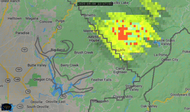
site: University of Wisconsin-Madison Space Science and Engineering Center - rEALeARTH
"RealEarth™ is a data discovery and visualization platform developed at SSEC/CIMSS at the University of Wisconsin-Madison to support outreach and collaboration efforts of scientists."
One of the best sites for visualizing B07 Enhanced Fire imagery from GOES West.
-
AmericaView - CO
-
Australia
-
Aviation
-
CIMSS
-
Clouds
-
Continental US
-
Cryosphere
-
Eclipse 2017
-
Fire Detection - VIIRS
-
Fires
-
Flood
-
Flood Detection - GEO
-
Flood Detection - Global
-
Flood Detection - Landsat8
-
Forecast
-
Geostationary
-
Global
-
GNC-A GOES-E
-
GNC-A GOES-W
-
GNC-A JPSS
-
GOES 15
-
GOES East ConUS
-
GOES East Full Disk
-
GOES East Meso 1
-
GOES East Meso 2
-
GOES West ConUS
-
GOES West Full Disk
-
GOES West Meso 1
-
GOES West Meso 2
-
Great Lakes
-
Hazards
-
High Res
-
Himawari Full Disk
-
Himawari Japan
-
Himawari Target
-
Hurricane
-
JPSS - Fire & Smoke
-
JPSS - Flood & Ice
-
JPSS - NUCAPS
-
Landsat
-
LEO
-
Lightning
-
MODIS
-
NAIP
-
NASA LaRC
-
NEXRAD - CanAm
-
NEXRAD - ConUS
-
NEXRAD - OConUS
-
NSSL
-
NWS Hazards/CMORPH
-
Observations
-
Polar Nav
-
Precipitation
-
Radar
-
Regional Imagery
-
Regional VIIRS Floods
-
Severe
-
Surface
-
Targets
-
True Color RGB
-
VIIRS
-
Winds
-
Winter
-
Wisconsin
-
WPC
-
Other


Random Gallery

